
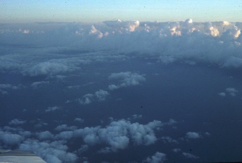
The morning glory
TROPICAL CLOUD LINES
The Gulf of Carpentaria and Cape York Peninsula region of northeastern Australia is distinguished for the regular occurrence there of a range of convective- and wave-cloud lines. These include the celebrated 'Morning Glory' phenomenon, a spectacular travelling wave-cloud system commonly observed over the southern part of the Gulf and adjacent seaboard (see Smith, 1988 and Christie, 1992 for recent reviews), and the so-called North Australian Cloud Line (NACL), a line of convective cloud that is seen in satellite imagery to extend frequently across the entire Gulf (Drosdowsky et al., 1989). Both types of disturbance form on the western side of the Peninsula, the former typically in the late afternoon and the latter in the late evening, and they both move with a westward component across the Gulf. Moreover, both are responsible for significant weather events in the region. The morning glory is accompanied by sudden wind squalls, intense low-altitude wind shear and a marked vertical displacement of air parcels, sometimes sufficient to initiate showers or thunderstorms in the wake of the disturbance. The NACL brings a wind change also and while the depth of convection is sometimes limited by an inversion at a height of about 3 km, embedded showers and thunderstorms may occur at times of the year when the air over the gulf is sufficiently moist. On occasion, the morning glory forms the southern extension of the NACL.
The morning glory
The north Australian cloud line
There is much evidence that the majority of both types of disturbance have their origin in organized mesoscale circulations that develop over the peninsula and adjacent gulf associated with sea breezes. However, some morning glory disturbances moving from the south are generated by frontal systems crossing central Australia (Smith et al., 1995).
In a recent work (Smith and Noonan, 1997) we have investigated thermally-forced atmospheric circulations over the Gulf of Carpentaria region of northeastern Australia using a mesoscale numerical model. We have shown that for uniform flows over the region ranging from northeasterly to southeasterly, westward-moving, low-level convergence lines develop over the gulf during the night and early morning. We suggest that the atmospheric counterpart of these is responsible for the initiation and maintenance of the cloud lines. For northeasterly and easterly flow, the convergence lines show little day-to-day variation, despite the relatively long inertial period in the region which is nearly two days. The calculations, which extend an earlier study we made, lead to a new hypothesis to account for the observed longevity of morning-glory bore waves. They provide also an explanation for the marked diurnal oscillation in the low-level easterly flow observed at Weipa during a field experiment to investigate the so-called North Australian Cloud Line.
In two further papers (Menhofer et al., 1997a, b) we present analyses of observations made on the morning glory during a field experiment in 1991.
A project is currently underway in conjunction with the Australian Bureau of Meteorology to develop methods to forecast these cloud lines, which can lead to severe weather at certain times of the year. Click here to view an animation of the generation of a convergence line over the Gulf of Carpentaria, based on a case study in September 1996. The animation shows a 48 h forecast of hourly surface wind vectors (indicated by arrows) and surface divergence/convergence (colour coded), starting at 2300 GMT on 09 September 1996. The calculations were performed using the Australian Bureau of Meteorology's Limited Area Prediction System (LAPS). The convergence line that forms in the model simulation on the morning 11 September (local time) corresponds well with the morning glory cloud line seen at 2132 GMT on 10 September (i.e. 0732 local time on 11 September).
More pictures of the morning glory
REFERENCES
Christie, D.R., 1992: The morning glory of the Gulf of Carpentaria: a paradigm for non-linear waves in the lower atmosphere. Aust. Met. Mag., 41, 21-60.
Drosdowsky, W., G. J. Holland and R. K. Smith, 1989: North Australian cloud lines. Mon. Wea. Rev., 115, 2645-2659.
Menhofer, A., R. K. Smith, M. J. Reeder and D. R. Christie, 1997a: “Morning glory” disturbances and the environment in which they propagate. J. Atmos. Sci. 54, 1712-1725.
Menhofer, A., R. K. Smith, M. J. Reeder and D. R. Christie, 1997b: On the structure of morning glory disturbances. Aust. Meteor. Mag., (in press).
Smith, R. K., 1988: Travelling waves and bores in the lower atmosphere: the ‘morning glory’ and related phenomena. Earth-Sci. Rev., 25,267-290.
R. K. Smith and J. A. Noonan, 1997: On the generation of low-level mesoscale convergence lines over northeastern Australia. Mon. Wea. Rev. (in press)
Smith, R. K., M. J. Reeder, N. J. Tapper and D. R. Christie, 1995: Central Australian cold fronts. Mon. Wea. Rev., 114, 19-38.
M. J. Reeder and R. K. SMITH, 1998: Mesoscale meteorology in the Southern
Hemisphere. Chapter 5
of Meteorology of the Southern Hemisphere. Ed. D. J. Karoly and D. Vincent.
American Meteorological
Society Monograph, No. 49, 201-241.
Date 15 January 2001
Return to Roger Smith's homepage